Posted on: April 27, 2025
Author: Midwest Storm Chasers
🌩️ Overview:
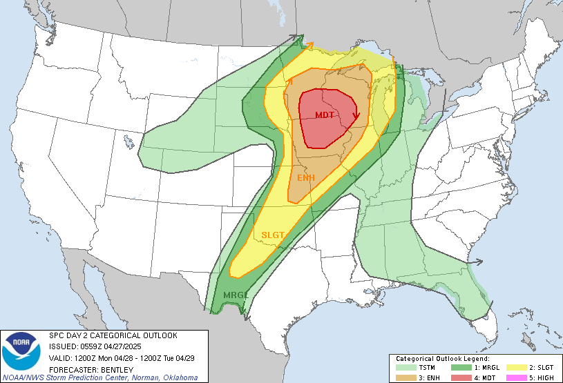
The Storm Prediction Center (SPC) has maintained a Moderate Risk (Level 4/5) for a major severe weather event across the Upper Midwest on Monday, April 28th.
Strong to intense tornadoes, very large hail, and widespread damaging winds are expected during the afternoon and evening hours.
🧩 Atmospheric Setup:
- A powerful 75-knot mid-level jet will sweep across the region.
- A deepening surface low will track across Minnesota, helping transport rich moisture northward.
- Mid-60s dewpoints and strong surface heating will create an extremely unstable environment (3000+ J/kg MLCAPE).
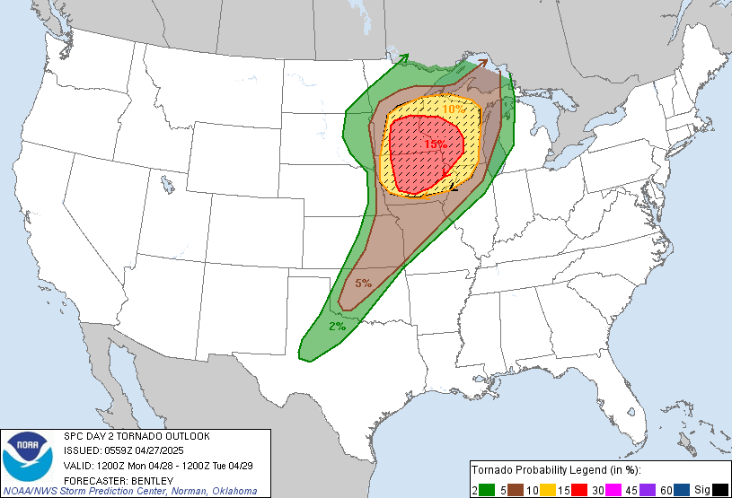
- Very strong low- and mid-level shear will support supercells capable of strong tornadoes.
🕐 Expected Timeline:
- Morning: Ongoing storms north of a warm front (hail possible across Minnesota and Wisconsin).
- Afternoon (2–4 PM CDT): Supercell development likely along the dryline in southern MN and central IA.
- Evening: Strong tornado potential with discrete supercells across Iowa, southern Minnesota, and western Wisconsin.
- Night: Severe squall line formation with damaging winds and embedded tornadoes.
🗺️ Greatest Risk Areas:
- Central and Eastern Iowa
- Southern and Southeast Minnesota
- Western and Central Wisconsin
Secondary risks extend into parts of eastern Kansas and Missouri.
🚨 Primary Threats:
| Hazard | Threat Level |
|---|---|
| Tornadoes | High – Strong to intense tornadoes likely |
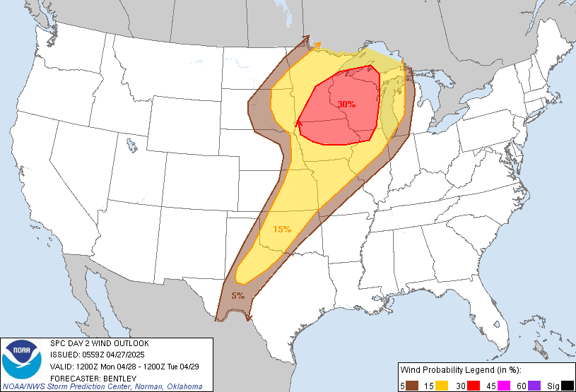
| Damaging Winds | High – Gusts 60–80+ mph possible |
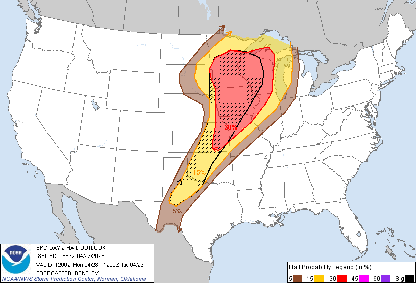
| Large Hail | High – 2″+ diameter hail likely with discrete storms |
| Localized Flooding | Low – Mainly isolated |
📢 MWSC Chase Plan:
Midwest Storm Chasers will deploy into central Iowa Monday morning, with flexible repositioning toward southeastern Minnesota or western Wisconsin depending on mesoscale developments.
Real-time updates and chase coverage will be posted throughout the day across our dashboard and social media platforms.
✅ Be Prepared:
- Have multiple ways to receive warnings.
- Know your safe shelter location.
- Charge all devices and review safety plans today ahead of Monday’s event.
🌪️ Final Notes:
The setup remains highly favorable for strong to intense tornadoes, particularly if discrete supercells can remain ahead of the cold front into the evening hours.
Stay tuned to Midwest Storm Chasers for updates as the situation evolves.
More Stories
⚠️ Special Weather Statement – Gregg; Harrison; Rusk; Panola – Sunday, July 12, 2026
⚠️ Severe Thunderstorm Warning – Potter, TX; Randall, TX – Sunday, July 12, 2026
⚠️ Special Weather Statement – Fannin; Lamar – Sunday, July 12, 2026