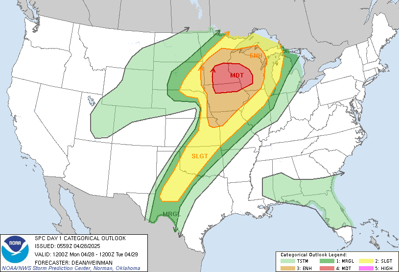
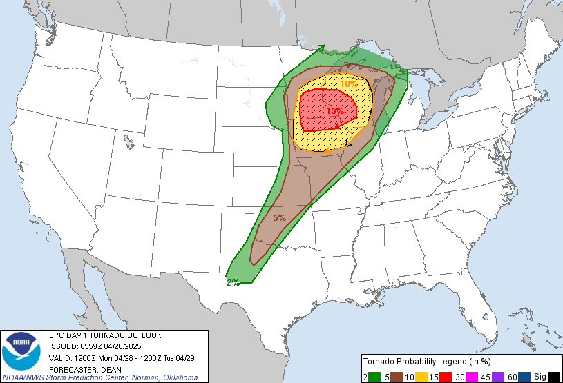
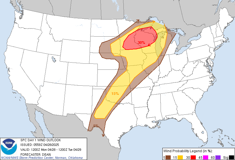
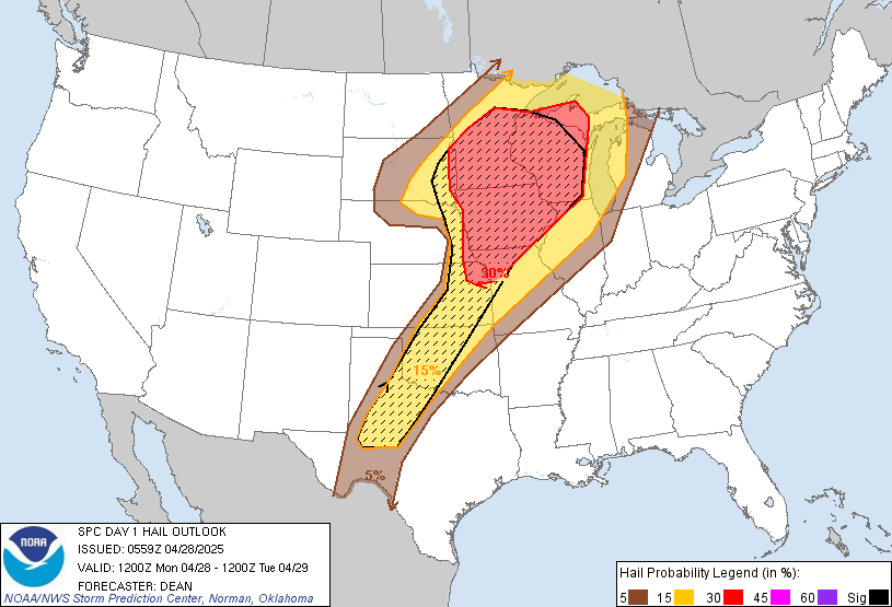
Today’s setup remains highly concerning for a regional severe weather outbreak across the Upper Midwest.
Moderate Risk (Level 4/5) is in place for southern Minnesota, northern Iowa, and western Wisconsin.
Key Details:
- Strong to intense tornadoes possible.
- Very large hail (2″ or larger).
- Damaging straight-line winds likely.
- Greatest threat timeframe: Mid-afternoon through late evening.
✅ Be Prepared:
- Have multiple ways to receive warnings.
- Know your safe shelter.
- Monitor updates throughout the day.
🚗 Our Midwest Storm Chasers team will be deployed in the field storm chasing today and will provide live updates as the situation develops.
More Stories
⚠️ Special Weather Statement – Rusk; Panola – Sunday, July 12, 2026
⚠️ Flash Flood Warning – Armstrong, TX; Randall, TX – Sunday, July 12, 2026
⚠️ Special Weather Statement – Sevier; Howard; Little River; McCurtain – Sunday, July 12, 2026