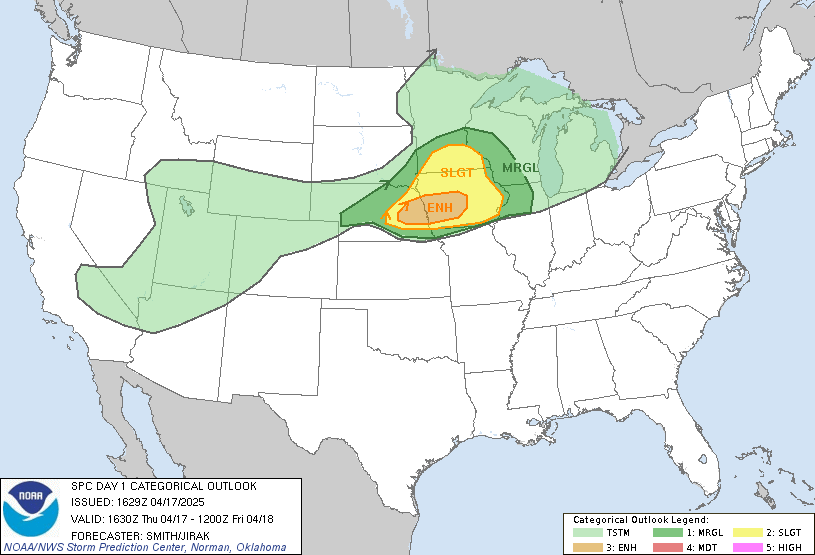
Posted: April 17, 2025 – 1:30 PM CDT
Author: Collin Leck, MWSC Operations Lead
📢 Chase Status: ACTIVATED
🟧 ENHANCED RISK in effect for eastern Nebraska into central Iowa
⚠️ Severe Thunderstorm Watch Expected for parts of southern Minnesota and northwest Iowa
🧭 Chase Objective
Most MWSC teams are staging in southern and central Minnesota, where storm initiation is likely between 2–4 PM CDT. We’re positioning near the triple point and along a strengthening moisture axis with increasing CAPE.
- Primary Target: Redwood Falls → Mankato → Owatonna, MN
- Secondary Targets: Storm Lake → Ames (IA), Norfolk → Omaha → Red Oak (NE)
🌩️ Threat Summary
- Hail: 1.75–3.5 inches possible
- Winds: Gusts up to 70 mph
- Tornadoes: A couple possible if storms remain discrete
🔎 SPC + Mesoscale Highlights
The SPC Day 1 Outlook and Mesoscale Discussion #0458 highlight the potential for isolated supercells capable of producing severe hail and damaging winds. Initiation is expected across southern Minnesota by mid-afternoon.
🕒 Chase Timeline
| Time | Action |
|---|---|
| 1:00–2:00 PM CDT | Final gear checks, deploy from MN staging zones |
| 2:00–4:00 PM CDT | Monitor initiation near Redwood Falls → Mankato |
| 4:00–7:00 PM CDT | Peak supercell window |
| 7:00–10:00 PM CDT | Possible clustering and southern redeployment |
📡 Live Coverage
Follow us throughout the day on:
Stay weather-aware and ready to take shelter if warnings are issued in your area.

More Stories
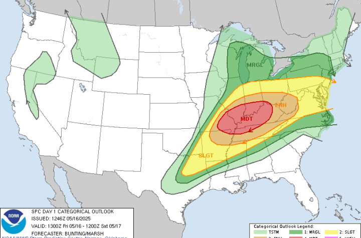
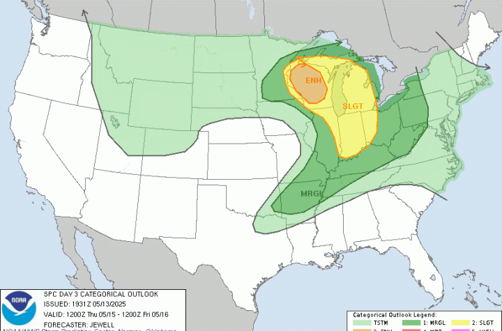
🌀 Midwest Storm Chasers Ops Desk Forecast📅 Day 3 Convective Outlook📍 Valid: Thursday, May 15, 2025 | 7:00 AM CDT – Friday, May 16, 2025 | 7:00 AM CDT📌 Issued: May 13, 2025 – 2:45 PM CDT📍 Lead Forecaster: Collin Leck
MWSC Forecast – Day 1 Severe Weather Outlook (Sunday, April 20, 2025)