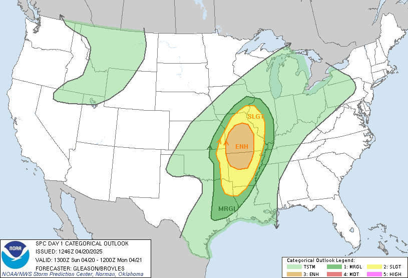
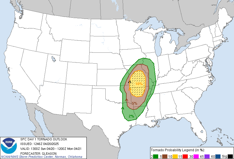
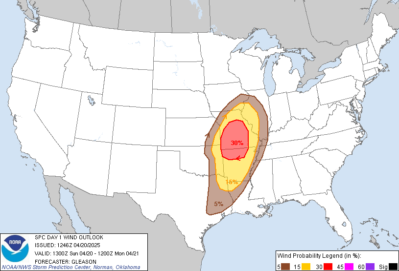
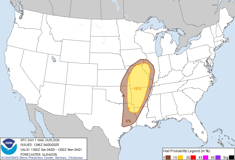
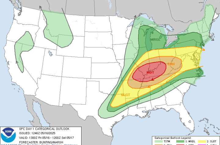
SPC Risk Level: Enhanced
Threat Zones: Central/Northern Arkansas, Missouri, Eastern Oklahoma
Summary
Severe thunderstorms are expected this afternoon and evening across parts of the ArkLaTex, Ozarks, and the mid-Mississippi Valley. The SPC highlights a corridor from central and northern Arkansas into Missouri for the highest threat of tornadoes (some strong) and damaging wind gusts.
Forecast Details
- A strong surface low and mid-level jet will support supercell development this afternoon
- Storms will likely initiate over eastern OK around 1–3 PM CDT and intensify as they move into AR and MO
- Main Threats:
- Scattered damaging wind gusts over 60 mph
- Strong tornadoes (EF-2+ possible)
- Large hail with sustained supercells
🛑 Safety Tips
- Have multiple ways to get warnings (radio, phone, apps)
- Know your shelter location ahead of time
- Move to a basement or interior room during Tornado Warnings
- Don’t rely solely on outdoor sirens
MWSC chasers are deployed and actively monitoring this evolving threat. We’ll be providing real-time coverage, live updates, and media as storms move through the region.


More Stories
🌪️ Severe Weather Outlook – Monday, May 19, 2025
🌀 Midwest Storm Chasers – Day 1 Severe Weather Forecast📅 Valid: Friday, May 16, 2025 | 7:00 AM CDT – Saturday, May 17, 2025 | 7:00 AM CDT📍 Target Regions: Mid-Mississippi Valley, Ohio Valley, Tennessee Valley
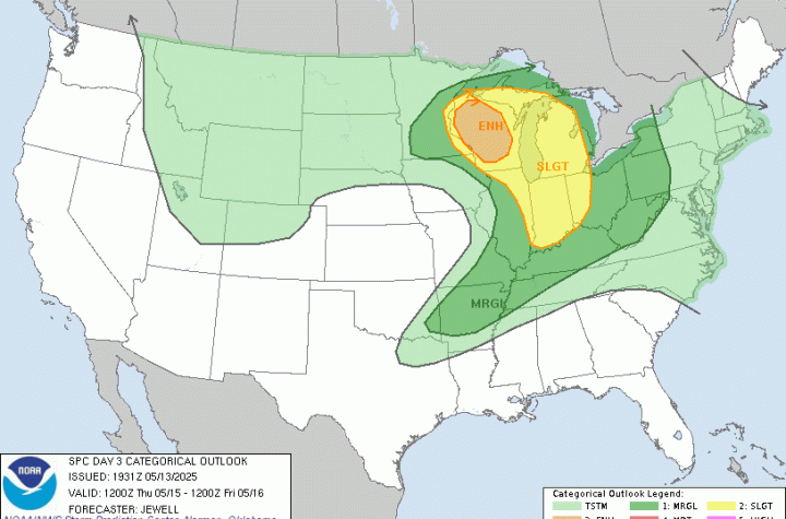
🌀 Midwest Storm Chasers Ops Desk Forecast📅 Day 3 Convective Outlook📍 Valid: Thursday, May 15, 2025 | 7:00 AM CDT – Friday, May 16, 2025 | 7:00 AM CDT📌 Issued: May 13, 2025 – 2:45 PM CDT📍 Lead Forecaster: Collin Leck